📷 Screenshots
Flight
Instruments, live compass & daylight countdown
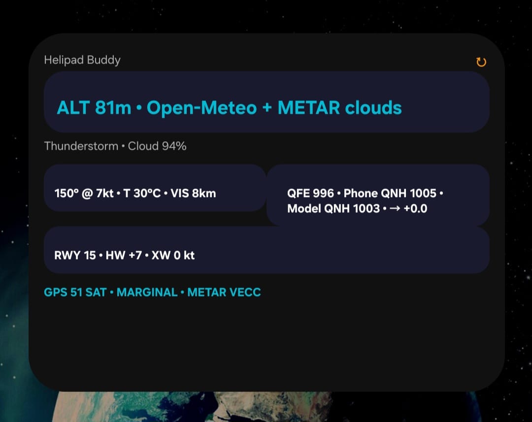
Widget
Home screen widget
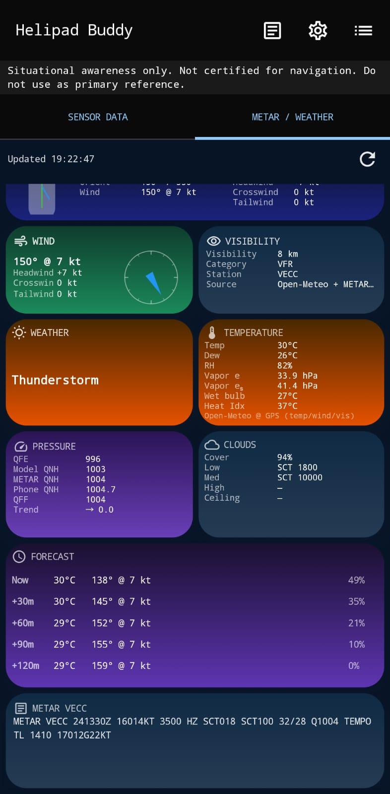
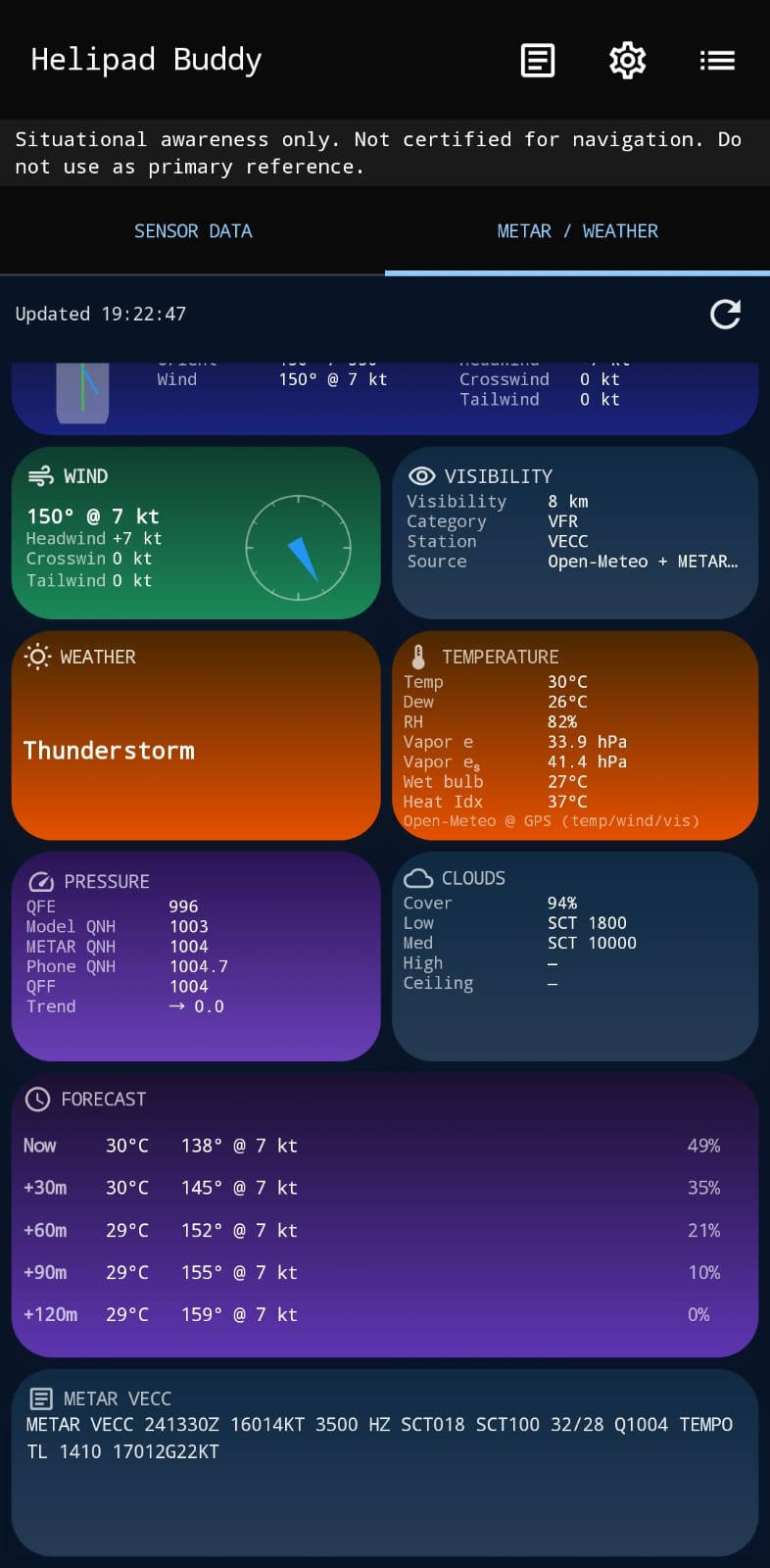
Weather
METAR or Open-Meteo, winds aloft
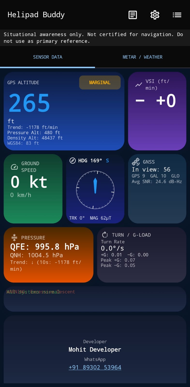
Sensors
Fusion & health diagnostics
Home / Products / Helipad Buddy
Helipad Buddy v2.2 combines GNSS with EGM96 MSL altitude, QFE / QNH on every phone, METAR or Open-Meteo weather, winds aloft from four global models, freezing level, runway & wind calculators, a live compass, and sun, moon & night-ops tools — built for pilots, drone operators, and aviation enthusiasts.
Android 7.0+ · Free · No ads, no tracking. Updated Oct 22, 2026.
Live latitude, longitude, ground speed, and MSL altitude corrected with the real EGM96 geoid.
From the phone's barometer, or derived from the nearest METAR or the weather model when the phone has none — every value shows its source.
ICAO Standard Atmosphere with humidity, using the temperature from your chosen weather source or your own OAT.
Eight-point dial that turns 20 times a second from fused sensors; track vs heading in °M with local magnetic variation.
Barometric VSI from a least-squares fit over three seconds — steady, responsive, and sink-rate alerting.
Signed turn rate with a standard-rate cue, load factor in g, and peak g held for review.
Margin to your HIGE and HOGE ceilings — entered from your own flight manual — against current density altitude.
GNSS satellites in view and in use by constellation, with signal strength.
Dim red display, switched on automatically by the light sensor or by hand.
Show every time in local time or Zulu, app-wide.
Record sessions, replay flights, chart them, and export CSV.
Sensor availability, accuracy, and fusion quality on one screen.
Pick your source: the Open-Meteo model at your GPS position, or the METAR from the nearest (or your chosen) station. Every tile follows that one choice — values are never mixed.
Wind and gusts, temperature, dew point, humidity, visibility, clouds, QNH, and flight category all come from the source you select. Switch any time on the Weather tab.
Gusts, variable wind, present weather, cloud layers and ceiling, observation time, and distance to the station. Flight category uses ceiling as well as visibility.
ICON, GFS, ECMWF, and GEM every 1,000 ft MSL to about 20,000 ft, from now to +12 hours. Compare the models side by side.
The 0 °C level in feet MSL and above ground, plus temperature, dew point, and humidity at your location. ❄ marks layers at 0 to −20 °C with 85 % humidity or more, where icing is possible.
QFE, QNH, and QFF with source labels — phone, METAR, or model — plus the pressure trend engine and density altitude.
Hourly forecast slots, wet bulb at station pressure, NWS heat index, vapour pressure, and a psychrometric calculator.
WINDS ALOFT · ICON · Now
Alt ft    Wind        Temp   RH
 3,000    250° 12 kt   +14°  62%
 5,000    260° 18 kt    +9°  70%
 7,000    265° 22 kt    +3°  81%
 9,000    270° 27 kt    −2°  88% ❄
0 °C level ≈ 8,300 ft MSL
Illustrative layout — values come from the live models.
Headwind, tailwind, and left/right crosswind for the active runway. METAR and forecast winds are true and runways are magnetic, so the local variation is applied.
Enter the wind you were given — tower or ATIS (magnetic) or METAR (true), with gusts — and get components for any saved runway end or any heading, with a diagram.
A live alert when the low sun sits on your approach, plus a timeline of today's glare windows for every runway end.
Save places with elevation and a linked runway. Setting the active helipad applies its field elevation (for QFE/QNH), astro location, and runway.
Headwind · Tailwind · Crosswind · Gusts · Magnetic variation
The full MSK Astronomy Console, offline on your phone — tuned for flying at dusk, at night, and under the moon.
Rise, set, transit, civil, nautical, and astronomical twilight, golden and blue hour. Tap the sky graph for the time and Sun and Moon angles at any moment.
Time to civil dusk or dawn on the Flight screen, an optional reminder notification before dusk, and a Daylight home-screen widget.
Hour-by-hour clear-sky illuminance from dusk to dawn — Dark, Low, Moderate, or Bright — from moon phase, altitude, and twilight.
Live camera view with the Sun, Moon, and planets drawn where they are. Picks the main 1× lens, measures its field of view, and aligns exactly with one tap on a known body.
Io, Europa, Ganymede, and Callisto — visible in binoculars — with their positions east or west of Jupiter.
Eclipses with local visibility, equinoxes and solstices, supermoons, and blue moons for the next 12 months, exportable to your calendar (.ics).
Also inside: yearly sun & moon tables, angle finder, planet rise & set, and moon phases — with CSV and PDF export.
Two weather widgets (full and compact) and a Daylight widget keep the essentials one glance away.
ALT MSL: 709 ft

METAR · 240° 8G18 kt
T 24°C · VIS 8 km

RWY27 ACTIVE
HW: +7 kt  XW: 3 kt L

QFE 990 (Phone) • QNH 1013

↻ RefreshPosition, speed, and satellites
GPS ellipsoid height → true MSL
QFE, pressure altitude & VSI
Heading, pitch & bank, any orientation
Turn rate about true vertical
Magnetic heading & local variation
Sky Finder live view
Automatic night vision
v2.0 introduced the widget system, Open-Meteo weather, runway calculations, and the pressure engine.
Instruments, live compass & daylight countdown
Home screen widget
METAR or Open-Meteo, winds aloft
Fusion & health diagnostics
Developers are welcome to enhance Helipad Buddy and contribute to its evolution.
Download Helipad Buddy v2.2 and turn your smartphone into a smart aviation console.
⬇ Download Nowv2.2.0 · 5.2 MB · Android 7.0+ · Free